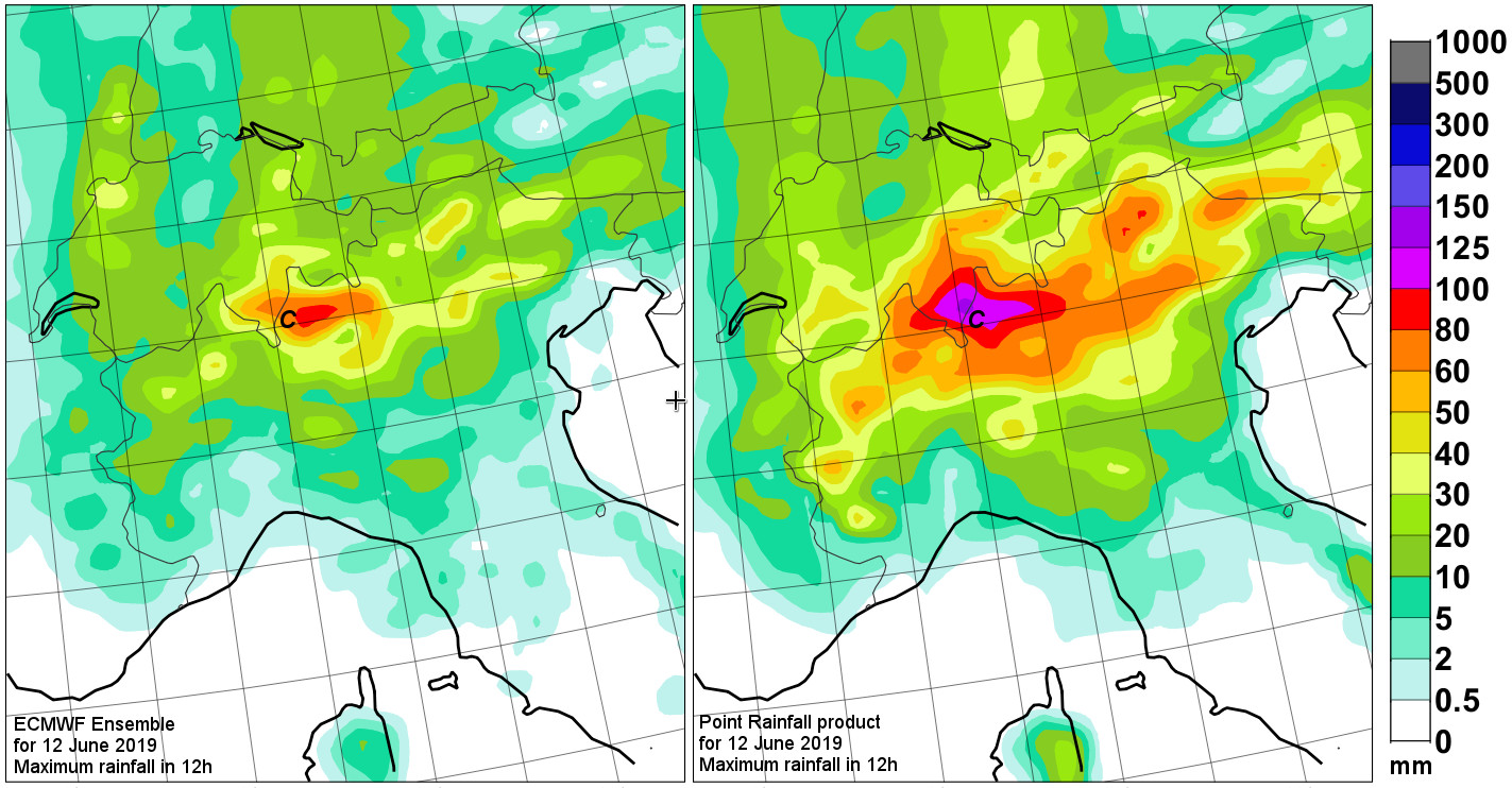
On the afternoon of 12 June 2019 flash floods caused disruption in the Lake Como area (labelled ‘C’ on the maps). ECMWF Forecasts from 36h before suggested a risk of high totals (left plot), but Point Rainfall output, being used directly in MISTRAL, gave a stronger indication, focussed close to the area where the floods occurred. Long term verification shows that the Point Rainfall forecasts provide more reliable and more accurate forecasts for extreme events such as these

 The MISTRAL project activites have been performed thanks to the INEA/CEF contribution under the grant agreement number: INEA/CEF/ICT/A2017/1567101 – Action No: 2017 IT IA-0144